
A natural monument with [pre]history
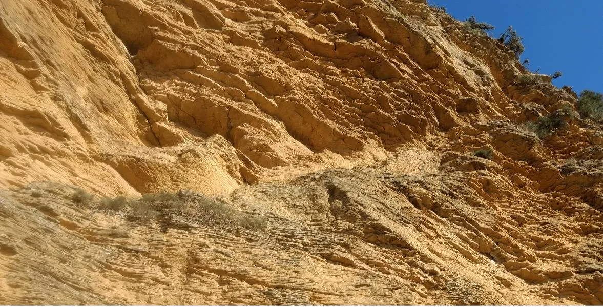
Overlooking the Genil River valley, in the village of Fuentes de Cesna (Algarinejo, Granada) and almost at the border with Córdoba, rises the Villavieja Cliffs. It is a natural formation that stands out from its surroundings. From this sandstone massif, one can view a continuous landscape of the lands of Granada, Córdoba, and Málaga, overlooking the Genil River valley, which currently forms part of the Iznájar Reservoir (Figure 1).

Amidst olive fields stands out a triangular plateau surrounded by a cliff over 30 meters high at its peak. This plain was used to establish the Villavieja settlement, whose origins date back to the Copper Age, maintaining residual occupation during the Bronze Age (2836 – 2026 cal. BC). The village, with an area of 2.5 hectares, is enclosed by a monumental curved wall built in rubble masonry, reinforced at regular intervals by buttresses and semicircular structures (Garzón, 2025; Morgado et al., 2013, 2023, 2024).
On the other hand, during the medieval period, both the base of the cliff and various caves (natural and excavated in rock) located halfway up were reused to develop dwellings, cisterns, and livestock spaces (Bermúdez and Ruiz, 2015; Morgado et al., 2013, 2023, 2024). Access to these structures was articulated through a path carved into the rock of the cliff, composed of ramp sections and staircases (Figure 2).
Moreover, it is worth noting that just a kilometer from this site lies the Cesna Castle —referred to by some Arabists as «Turrush Castle»—, located on a promontory along the riverbank of the Genil River. This castle, with a possible Visigothic origin, belonged to Ardabasto —son of Witiza, the last Visigoth king—who ceded it to the Omeyas, according to Arjona (1979). It was intensively used during the Middle Ages; its occupation spanned from the Emirate period—when it served as a refuge for Abderramán I before entering Córdoba—to the Nazari era (13th-15th centuries), when it was taken by Christian troops. In this sense, there may have been a relationship between the structures of the cliff and those of the castle itself; however, this connection has yet to be studied or at least is not referenced in documentation.
Cultural and Identity References
To the west of this natural monument lies the deserted village of Fuentes Viejas, a settlement located on an opposite plateau, sharing the same geological and sedimentary nature as the Cliffs. What appears today as a lush greenery was, until just a few decades ago, a living village (Figure 3). However, the instability of the terrain tragically manifested itself from the 1940s, culminating in the early 1970s when a series of natural disasters and rockfalls devastated the enclave. This last episode claimed several lives and marked the definitive abandonment of the settlement. Survivors, deprived of their homes, were forced to seek refuge with relatives or be rehoused in provisional shelters built two kilometers away; a cluster of houses that over time gave rise to the current population of Fuentes de Cesna (Algarinejo).

Nevertheless, the Cliffs have never gone unnoticed by the inhabitants of the deserted village—then—and the new settlement—now—. The local community has always held a mystical interest in this enclave, fascinated by its imposing silhouette in the landscape and the presence of a cave historically used by shepherds as a stable. This was also supplemented by news about archaeological finds made by «curious» individuals on the plain. This last point led to the start of archaeological interventions in 2012 that uncovered the Copper Age settlement and initiated scientific research in the area (Morgado et al., 2013).
Thus, both the Cliffs and the deserted village are configured as a cultural and identity reference that fits UNESCO's definition of cultural landscape (2019):
«[...] cultural properties [that] represent the «joint works of man and nature». They illustrate the evolution of human society and its settlements over time, under the influence of physical limitations or advantages presented by their natural environment and successive social, economic, and cultural forces, both external and internal» (Annex 3, paragraph 6).
The Cliffs are not only distinguished by their undeniable landscape value but also by the wealth of local traditions and legends they harbor, making them a fundamental symbol of belonging for surrounding communities, their cortijadas, and especially for Fuentes de Cesna.
Legends, Traditions, and Memory
Among the oral traditions that are transmitted among inhabitants, several local legends stand out. Although some of them have already been recorded in writing—precisely to safeguard popular knowledge and memory linked to the monument (Gámez, 2010)—most remain alive in collective imagination.
A significant part of this legendary corpus revolves around the previously described rock cavity. In collective imagination, this cave is conceived as a threshold to two possible underground realities: on one hand, an entirely hollow cliff interior with only a peripheral «shell» remaining and, on the other, an intricate network of secret galleries descending to connect with the Genil River bed. According to popular belief, this passage was used as a safe escape route or communication channel between the Cliffs and the valley, thus bypassing a distance of one kilometer.
Beyond myth, some of these traditions enclose a strong element of reality linked to daily life. This is the case of what is called «The Nine Stone», a point on the natural monument that villagers used as a time reference. Located at the vertex of the triangle and oriented eastward, this rock began to shine brightly precisely when the sunrise reached its position, marking naturally the start of the working day in the fields (Gámez, 2010).
Conclusion
The Villavieja Cliffs, together with the deserted village of Fuentes Viejas and Cesna Castle, form a valuable cultural landscape and rich heritage where local memory, history, and nature go hand in hand. Thus, this enclave offers the possibility to be studied integrally or individually from archaeology and ethnography, among other disciplines, as it has marked key processes for the habitability of the area since Prehistory until today. This historical continuity has fostered the rooting of heritage manifestations, cultural references, legends, and oral narratives that continue alive about the natural formation. Today, these places remain at the heart of Fuentes de Cesna's identity and history.
Bibliography
Arjona, A. (1979). The Castle of Turrush. Boletín de la Real Academia de Córdoba de Ciencias, Bellas Letras y Nobles Artes, 100, 257-264.
Bermúdez, R. and Ruiz, F. (2015). Participation of the G40 Speleological Group in the archaeological project of Villavieja Cliffs (Algarinejo, Granada). Gota a Gota, 8, 83-93.
Gámez, J. (2010). Cien años en las Cabreras (el honor de los Camperos). Publicaciones Obra Social y Cultural de CajaSur.
Garzón, J. (2025). Architectural analysis of the walled enclosures of the Copper Age in Andalusia [PhD thesis, University of Granada]. https://hdl.handle.net/10481/102605
Jiménez, M. and Mattei, L. (2014). The medieval archaeological heritage of the Western Granada Region (Alhama, Loja, and Western Mountains). Alhulia.
Morgado, A., García, D., Bermúdez, R., Bueno, J. A., Iglesias, R., Marín, T., Ortega, C., Ros, L. and Beltrán, J. (2024). Archaeological documentation and interpretation of the central sector of the Copper Age wall at Villavieja (Fuentes de Cesna-Algarinejo, Granada). Antiqvitas, 36, 14-40.
Morgado, A., Garzón, J., García, D. and Bueno, J. A. (2023). Villavieja (Fuentes de Cesna-Algarinejo, Granada). New contributions to the walled settlements of the Copper Age in Andalusia's Subbetic region. Complutum, 34(2), 351-374. https://doi.org/10.5209/cmpl.92259
Morgado, A., Martínez, F., Garzón, J., Jiménez, F., Ruíz, F., Gutiérrez, M., Fernández, S., Ortiz, J. M. and Lozano, J. A. (2013). Villavieja (Algarinejo, Granada), a Copper Age walled enclosure in the Western Granada Region. Advance of the 2012 Campaign. Antiqvitas, 25, 39-48.


Comments